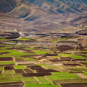
Farm Pin Crop Detection Challenge
'%3e%3cpath fill='%23001489' d='M0 0v6h9V0z'/%3e%3cpath fill='%23e03c31' d='M0 0v3h9V0z'/%3e%3cg stroke='%23fff' stroke-width='2'%3e%3cpath id='d' d='m0 0 4.5 3L0 6m4.5-3H9'/%3e%3cuse xlink:href='%23b' stroke='%23ffb81c' clip-path='url(%23c)'/%3e%3c/g%3e%3cuse xlink:href='%23d' fill='none' stroke='%23007749' stroke-width='1.2'/%3e%3c/g%3e%3c/svg%3e)
Helping South Africa
$11 000 USD
Completed (over 6 years ago)
Classification
Earth Observation
1463 joined
42 active
Start
Mar 04, 19
Close
Sep 15, 19
Reveal
Sep 16, 19

How do i view the images ? ..
Help · 13 Mar 2019, 13:01 · 1
all i see are just xml files and stuffs..who can help on hoe to view the images
Hello Caroluslinus, depending on the language of your choice i think GDAL2 package is the best Geospatial Data Abstraction Libarary out there. you could take some time reading about it. thanks