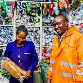
Sendy Logistics Challenge
'/%3e%3c/defs%3e%3cpath fill='%23fff' d='M-120-80h240V80h-240z'/%3e%3cpath d='M-120-80h240v48h-240z'/%3e%3cpath fill='%23060' d='M-120 32h240v48h-240z'/%3e%3cg id='b'%3e%3cuse xlink:href='%23a' stroke='%23000'/%3e%3cuse xlink:href='%23a' fill='%23fff'/%3e%3c/g%3e%3cuse xlink:href='%23b' transform='scale(-1 1)'/%3e%3cpath fill='%23b00' d='M-120-24v48h101c3 8 13 24 19 24s16-16 19-24h101v-48H19C16-32 6-48 0-48s-16 16-19 24z'/%3e%3cpath id='c' d='M19 24c3-8 5-16 5-24s-2-16-5-24c-3 8-5 16-5 24s2 16 5 24'/%3e%3cuse xlink:href='%23c' transform='scale(-1 1)'/%3e%3cg fill='%23fff'%3e%3cellipse rx='4' ry='6'/%3e%3cpath id='d' d='M1 5.85s4 8 4 21-4 21-4 21z'/%3e%3cuse xlink:href='%23d' transform='scale(-1)'/%3e%3cuse xlink:href='%23d' transform='scale(-1 1)'/%3e%3cuse xlink:href='%23d' transform='scale(1 -1)'/%3e%3c/g%3e%3c/svg%3e)
Helping Kenya
$7 000 USD
Completed (over 6 years ago)
Prediction
2192 joined
448 active
Start
Aug 23, 19
Close
Nov 25, 19
Reveal
Nov 26, 19

Using Uber movement data
Help · 4 Nov 2019, 14:34 · 9
In Uber Time, can anyone share how to obtain Sourceid and dstid from Longitude and Latitude?
Hello,
u can use Point and Polygon from shapely : from shapely.geometry import Point, Polygon
create your point and polygon :
p = Point(24.952242, 60.1696017) poly = Polygon( [(24.950899, 60.169158), (24.953492, 60.169158), (24.953510, 60.170104), (24.950958, 60.169990)])
after that you can check if your polygon contains your point :
poly.contains(p)
or if your point is in polygon :
p.within(poly)
Thanks Yos.This makes sense. I will try it.
There is a json file called sublocations in the uber data defining the boundaries of each 'district' in Nairobi. You have to use a geocoding library to map your points ( you have to do some searching inside the polygones ) to those districts.
The ID's obtained are sourceid for a pickup point, dstid for a destination point.
Thanks Blenz. I have downloaded the sublocations file. Will try now.
Has adding the Uber movement data improve the results for anyone?
same question here
Uber data did'nt give me much improvement
@seddik11, how many seconds improvement did you get on the leaderboard?
Hardly anything