Côte d’Ivoire Byte-Sized Agriculture Challenge

Tabular is provided and you are encouraged to download satellite data to enrich your model. Participants can derive relevant features from satellite data to predict crop type.
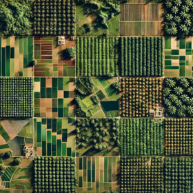
The training data should include imagery captured across a full one-year period, allowing for rich temporal variability and robust feature extraction from seasonal patterns. Your model must generalise from the diverse training set and accurately classify the test imagery.
You may download your own satellite data for this challenge, but the winning solutions must be compatible with satellite data sourced from the Copernicus Data Space Ecosystem.
Time-stamped satellite images provide a valuable foundation for building pixel-level classification models to distinguish between cocoa, oil palm, and rubber plantations, supporting Tolbi’s mission to drive smarter agricultural decisions through precision mapping and remote sensing. By leveraging multi-temporal data, the classification model captures the unique seasonal growth patterns and phenological differences of each crop type over time, significantly enhancing the model’s ability to differentiate crops that may appear visually similar in single-date imagery. Models must not be trained using spatial features derived from the provided geometries. All feature engineering should be based solely on the satellite imagery. At test time, models should operate without access to any geometry-related information, simulating real-world, geometry-free deployment conditions.
Join the largest network for
data scientists and AI builders