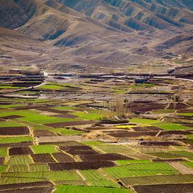
Farm Pin Crop Detection Challenge
Dear Zindi community,
Referring to this discussion: http://zindi.africa/discussions/316
Models that use the Field ID as a feature will not be accepted as a winning solution.
Please understand that this challenge addresses a real world problem that can change the way agricultural activity is monitored in Africa, by using satellite images. The solution needs to be replicable to be useful.
Zindi is a community that has the power to solve the continent's most pressing challenges, so we must consistently produce valuable solutions to those companies and organizations that turn to Zindi for help.
The Field IDs represent a data leak. We should have included a note on this in the rules. Though we do reserve the right to change the rules at any time, we realize this is short notice.
Therefore, this is to notify everyone on the leaderboard that we will extend the deadline of the competition to 15 September and also increase the submission limit to 10 per day. We will take the competition down for a few minutes and reset the leaderboard around 9am GMT on Saturday 31 August. After that, you can continue to make your submissions excluding the Field ID.
We realize that this was a mistake on our part. So we to make it up, we will also put an additional $1,000 in the prize pot, for a total of $11,000 up for grabs to the top 3 winners.
In the future, if you have doubts about what should be allowed into a competition, or if you stop a data leak, we appreciate that you reach out to us.
Thanks for your patience on this matter. Good luck. We can hardly wait to see what you come up with!
The Zindi Team
Thanks
Thanks DrFad. We always thought, especially with the small fields, you would need to create features from the fields around it. That is why we decided not to cut the images per field, but rather gave you the whole scenes. You should not use Field_ID. And you should not create "by hand" a few naming convention that mimics the Field_IDs. However, we will let you use latitude and longitude to create features for your model.
In the rules section, you are yet to update to 10 submissions per day. Currently, It reads a limit of 5.