Lacuna - Correct Field Detection Challenge
Helping East Africa
$10 000 USD
Completed (over 4 years ago)
Prediction
Earth Observation
632 joined
110 active
Start
Mar 26, 21
Close
Jul 04, 21
Reveal
Jul 04, 21
Is PlotSize_acres same as the area of the image provided?
Data · 22 Apr 2021, 14:00 · 0
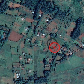
In the data description it is mentioned that the resolution for the Planet Lab images is ~4.7m (this means that each pixel covers (4.7x4.7)m2 of the real area on the ground). Each Planet Lab image is of approximately 84x84 size, so we can calculate the corresponding area on the ground as (4.7x4.7)x(84x84) which comes out to be approximately 155867.04 m2 that is similar to 38.515 acres. If we check the `PlotSize_acres` column in `train.csv` then all values are very small compared to this value, the max value is 5.5 acres.
Does `PlotSize_acres` mean something else than what I am interpreting or is there something wrong with the data?
Discussion 0 answers