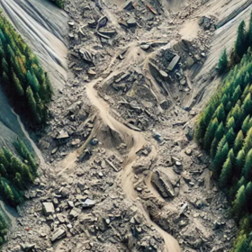
Classification for Landslide Detection by ITU
1 000 CHF
Completed (12 months ago)
Classification
Earth Observation
Python
GIS
Computer Vision
Machine Learning
Deep Learning
1020 joined
303 active
Start
Apr 17, 25
Close
Aug 04, 25
Reveal
Aug 04, 25

More detailed data description
Data · 2 Jul 2025, 21:03 · 5
Hi,
Is there a more precise description of the data somewhere?
I understand we are dealing with Sentinel-1 and Sentinel-2 data, but the description is a bit vague:
> The dataset includes post-event radar imagery, which captures backscatter intensity changes on the ground, and change detection bands calculated by subtracting pre-event from post-event data.
So is the Sentinel-2 image from before?
There are then ascending and descending versions of Sentinel-1. Are these post event?
There are then "Diff" versions of Sentinel-1 ascending and descending.
Are these then Sentinel-1 scans from before/after subtracted from each other?
I guess the diff versions are the pre and post event difference.
Hi, the Difference channels are post - pre event. All the other channels are post event. Please note that post event imagery alone does not capture changes.
Band Descriptions:
Ah, Ok thanks.
So the only pre-event info is in the diff channels if I understand correctly.
Hello!
I wonder why we dont get a pre-image of Sentinel-2 as well? I strongly assume that it would bring a lot of value to the model by giving more context information. Some images show little white spots that are easily misclassified as landslides. A pre-image would likely show the very same spots and the model could be almost-sure that thats an individual landscape characteristic.
Good point! And yes it I agree it would.