Côte d’Ivoire Byte-Sized Agriculture Challenge


Dear Zindians,
The data has been updated to include all 12 spectral bands.
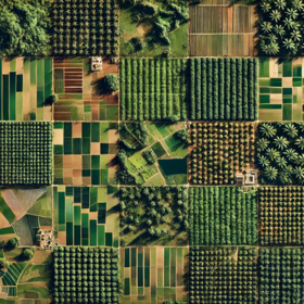
Sentinel-2 Imagery Data Overview
Sentinel-2 imagery has been uploaded for both the training and test datasets, each containing all 12 spectral bands. Geometries are provided only for the training data to support supervised learning and feature extraction. No geometries are included in the test data, as model inference is expected to be entirely image-driven.
You are also welcome to source and download your own Sentinel-2 imagery.
Important: Models must not be trained using spatial features derived from the provided geometries. All feature engineering should be based solely on the satellite imagery. At test time, models should operate without access to any geometry-related information, simulating real-world, geometry-free deployment conditions.
Data Collection and Processing Summary
Sentinel-2 (COPERNICUS/S2) satellite imagery was collected and pre-processed using a standardized pipeline. For each monthly interval and area of interest (AOI), the following steps were applied:
- File Management & Redundancy Checks Unique filenames are generated based on the AOI and date. Before downloading, local storage is checked for existing files; if a file exists and is under 30KB, it is flagged for re-download.
- AOI Size Normalization AOIs smaller than a defined minimum threshold (~0.0045 degrees in width or height) are automatically expanded. This prevents export failures and ensures consistent spatial coverage, by centering the AOI and expanding it to meet the minimum area requirement.
- Image Collection & Filtering Sentinel-2 imagery is filtered by:
- Date (specific to the month)
- AOI bounds
- Cloud coverage under 50%
- Selection of 12 spectral bands (B1–B12, excluding B10)
- Mosaicking & Band Validation Monthly image collections are mosaicked to ensure full coverage. Mosaics are validated to confirm all required bands are present.
Export Configuration Final mosaics are exported as Cloud-Optimized GeoTIFFs at 10-meter resolution to a designated Google Drive folder.
Thanks!
Perfect. Let the games begin!
Hey @Amy_Bray, thanks for the update.
It seems that "trainGeo.geojson" does not download. It results into an error when clicked on
Good work now! Gets get rolling!
Hey @Ami_Bray
I can't download the geojson file. I get an error when I try.
Thank you for the update. Everything is now set.