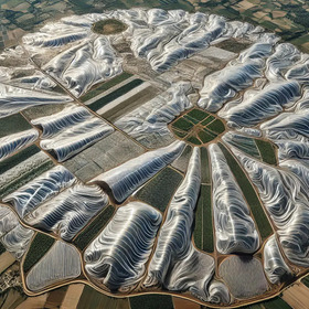
GeoAI Agricultural Plastic Cover Mapping with Satellite Imagery by ITU
Participants should use all free-accessible satellite data (e.g. Landsat, Sentienl-1/2) in the test regions, the data pre-processing methodology are not limited, either. We will provide the example GEE JS scripts in code editor to generate 15-day composited Sentinel-2 time series data in the three test regions (Spain, Kenya and Vietimn). The participants need to share the availability of the data they used and how the pre-processing is conducted, if they used more data than the official provided data set.
We will provide a limited number of training samples for plastic cover mapping, participants can also collect some training samples by themselves as cropland extent can be visually interpreted from Google Earth and Satellite images. It is notable that the training samples we are providing are collected by visually implement of satellite in April and May of each test region.
If you are in the top 10 at the end of the challenge and receive the request for code email you must include the following:
- The bi-weekly spatial distribution of the agricultural plastic covers in all the three test regions during 2023
- Executable and technical document describing the algorithm and procedure.
- Training samples with the features used for the classification procedure. We will provide training samples, and the participants could add training samples by themselves.
- Code used for data processing.
Note: we will evaluate the potential of the submitted code for data processing according to the technical document (from the RAW data to the resulting maps); the submission will not be accepted if the methodology is evaluated as unrepeatable. The submitted script is limited to python and Google Earth Engine JavaScript.
The satellite data are available by GEE with following script.
var Kenya_IC = ee.ImageCollection("users/pengyuhao/FAO/GEO-AI_2024/Kenya_IC")
var Spain_IC = ee.ImageCollection("users/pengyuhao/FAO/GEO-AI_2024/Spain_IC")
var VNM_IC = ee.ImageCollection("users/pengyuhao/FAO/GEO-AI_2024/VNM_IC")
Features in the training samples are prepared with images on 20240416 for VNM and Spain and on 20240501 for Kenya.
Join the largest network for
data scientists and AI builders