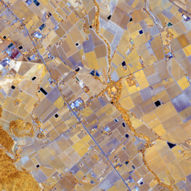
ICLR Workshop Challenge #2: Radiant Earth Computer Vision for Crop Detection from Satellite Imagery
'/%3e%3c/defs%3e%3cpath fill='%23fff' d='M-120-80h240V80h-240z'/%3e%3cpath d='M-120-80h240v48h-240z'/%3e%3cpath fill='%23060' d='M-120 32h240v48h-240z'/%3e%3cg id='b'%3e%3cuse xlink:href='%23a' stroke='%23000'/%3e%3cuse xlink:href='%23a' fill='%23fff'/%3e%3c/g%3e%3cuse xlink:href='%23b' transform='scale(-1 1)'/%3e%3cpath fill='%23b00' d='M-120-24v48h101c3 8 13 24 19 24s16-16 19-24h101v-48H19C16-32 6-48 0-48s-16 16-19 24z'/%3e%3cpath id='c' d='M19 24c3-8 5-16 5-24s-2-16-5-24c-3 8-5 16-5 24s2 16 5 24'/%3e%3cuse xlink:href='%23c' transform='scale(-1 1)'/%3e%3cg fill='%23fff'%3e%3cellipse rx='4' ry='6'/%3e%3cpath id='d' d='M1 5.85s4 8 4 21-4 21-4 21z'/%3e%3cuse xlink:href='%23d' transform='scale(-1)'/%3e%3cuse xlink:href='%23d' transform='scale(-1 1)'/%3e%3cuse xlink:href='%23d' transform='scale(1 -1)'/%3e%3c/g%3e%3c/svg%3e)

Hi everyone,
First, congratulations to all winners and participants of this challenge.
I have not taken part in this competition due to time constraints but I have been working recently on developing a tool for data augmentation in Keras that allows the use of hyperspectral images. As we all know, the current implementation of ImageGenerator Keras only allows up to 4 channels which is not ideal and that is due to the fact that they use Pillow library for image processing.
I have developed this open tool for augmentation that uses sklearn for image processing and allows numerous channels for image processing. It is work in progress as I plan to make it more suitable for satellite tiled images in the future and allow random crops from the original tiled images but in the meantime, feel free to experiment with it and let me know if you face any difficulties.
Thanks for sharing. Great