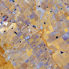
ICLR Workshop Challenge #2: Radiant Earth Computer Vision for Crop Detection from Satellite Imagery
'/%3e%3c/defs%3e%3cpath fill='%23fff' d='M-120-80h240V80h-240z'/%3e%3cpath d='M-120-80h240v48h-240z'/%3e%3cpath fill='%23060' d='M-120 32h240v48h-240z'/%3e%3cg id='b'%3e%3cuse xlink:href='%23a' stroke='%23000'/%3e%3cuse xlink:href='%23a' fill='%23fff'/%3e%3c/g%3e%3cuse xlink:href='%23b' transform='scale(-1 1)'/%3e%3cpath fill='%23b00' d='M-120-24v48h101c3 8 13 24 19 24s16-16 19-24h101v-48H19C16-32 6-48 0-48s-16 16-19 24z'/%3e%3cpath id='c' d='M19 24c3-8 5-16 5-24s-2-16-5-24c-3 8-5 16-5 24s2 16 5 24'/%3e%3cuse xlink:href='%23c' transform='scale(-1 1)'/%3e%3cg fill='%23fff'%3e%3cellipse rx='4' ry='6'/%3e%3cpath id='d' d='M1 5.85s4 8 4 21-4 21-4 21z'/%3e%3cuse xlink:href='%23d' transform='scale(-1)'/%3e%3cuse xlink:href='%23d' transform='scale(-1 1)'/%3e%3cuse xlink:href='%23d' transform='scale(1 -1)'/%3e%3c/g%3e%3c/svg%3e)
Helping Kenya
$5 000 USD
Completed (over 6 years ago)
Classification
Earth Observation
654 joined
110 active
Start
Feb 03, 20
Close
Mar 28, 20
Reveal
Mar 29, 20

I did this without noticing - is there any way I can remove my score?
Yes, please email zindi@zindi.africa with the submissions you would like us to remove.
Thanks at Zindi Anyone using the Field should cancel his submission let make the Leaderboard looks real.
May dates be used? Photosensitivity changes over time for crops.
Unfortunately, dates cannot be used. We want to reiterate that this is a computer vision challenge, therefore your models should not use metadata.
Can the dates be used as IDs to reconstruct the 2x2 grid (00 01 02 03) into a single mosaic?
Yes, if you are taking the approach of viewing the mosaic as a 'single image'. However, you cannot use the dates a feature in your modeling.
Can field location (not ID) be used as an input?
Yes.
Many thanks for your speedy responses. May I suggest such statements are reflected in rules as you make them.
@DrFad something about the location is here
Can we use Field ID in preprocessing? to get features as min or max value in field ID
No, you may not.
But I believe area of a field can be used as confirmed by the host on another discussion??
You can use the field ID to group and derive field-based features such as area or maximum NDVI. But you cannot derive any features from the field ID (as a numeric column) itself
Thanks so using row_loc, col_loc as a feature does not violate the rule?
It should violate it because it signifies the coordinates of the field which they've said is not allowed as a feature.
waiting for @Zindi reply on this
When making a prediction for a field, you must use the image data only. No variables to do with fields that have similar IDs, no information from nearby fields. This also means that you cannot use the field locations (pixel locations or otherwise) as features. This is to ensure that the solution is applicable elsewhere, outside of the area covered by this dataset.
Thanks for the clarification
Dear Zindi Team,
Thanks for your clarifications. We are still unclear about the rules and would appreciate if Zindi could update their rule set. There are a variety of useful clarifications in this thread which are not explicitly covered by the rules in our opinion. It would be great if the rules could be updated so people don't have to read through all the posts to understand the nitty-gritty details of the rules expected by Zindi. Which data can be used in preprocessing and training? The current wording "Models that use metadata such as dates or spatial coordinates" is not definite.
There is also still a confusion apparently evident in this post: https://zindi.africa/competitions/iclr-workshop-challenge-2-radiant-earth-computer-vision-for-crop-recognition/discussions/788 whether we can use any new features derived on calculations using the field ID (e.g. aggregating values per field ID).
Thank you!
Thank you all for pointing out these questions. Please see the clarification we just added to the other discussion (https://zindi.africa/competitions/iclr-workshop-challenge-2-radiant-earth-computer-vision-for-crop-recognition/discussions/806) to address these questions. If there is any remaining questions, feel free to post.