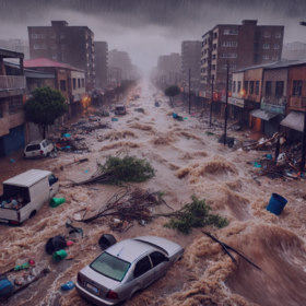
Inundata: Mapping Floods in South Africa
'%3e%3cpath fill='%23001489' d='M0 0v6h9V0z'/%3e%3cpath fill='%23e03c31' d='M0 0v3h9V0z'/%3e%3cg stroke='%23fff' stroke-width='2'%3e%3cpath id='d' d='m0 0 4.5 3L0 6m4.5-3H9'/%3e%3cuse xlink:href='%23b' stroke='%23ffb81c' clip-path='url(%23c)'/%3e%3c/g%3e%3cuse xlink:href='%23d' fill='none' stroke='%23007749' stroke-width='1.2'/%3e%3c/g%3e%3c/svg%3e)
Composite cloudless images of the areas of interest have been provided along with daily CHIRPS preciicpation data from 1981 to 2023.
An imbalance dataset is provided to you with some events containing an event and some events do not contain a flood. Both sets of events contain randomly select 40-60 weeks prior and post flood date, to ensure the flood event date is not always the middle index.
For each location the CHIRPS precipitation data has been aggregated over a 5km radius.
Composite cloudless images of the areas of interest have been provided along with daily CHIRPS precipitation data from 1981 to 2023.
Data for 2 years, 730 days was collected. Somewhere in these 730 days per location/event ID there could be a flood. Due to the sparsity of identified floods we have created an imbalanced dataset where there are some "events" or "locations" that do not have a flood in any of the 730 days.
If there is a flood for that event it can happen on any ONE of those 730 days. We have done this to ensure that you do not always select the middle day as the flood day.
The unique IDs are structured as event_id_X_day, event_id is a unique event that can contain a flood or might not. The day is a linear time step. You can think of event_id_X_1 being the 01/01/2024 and event_id_X_2 being 02/01/2024 (dd/mm/yyyy). We have excluded the actual dates so you can not go onto GEE to determine the value and that your model can be applied to any 2-year time period.
For each location the CHIRPS precipitation data has been aggregated over a 5km radius.
Please note that some locations do not have a composite image as these flood events were before the start of Sentinel-2.
The composite image contains 6 bands; these bands are
- Sentinel 2 B2 (Blue)
- Sentinel 2 B3 (Green)
- Sentinel 2 B4 (Red)
- Sentinel 2 B8 (NIR)
- Sentinel 2 B11 (SWIR)
- slope (derived from NASA SRTM)
Join the largest network for
data scientists and AI builders