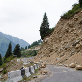
The common practice of identifying landslides is visual interpretation which, however, is labor-intensive and time-consuming. Thus, this hack will focus on automating the landslide identification process using artificial intelligence techniques, and target at using high-resolution terrain information to perform the terrain-based landslide identification.
The objective of this hackathon is to classify if a landslide occured or not.
There are ~10 000 entries in the train file and ~5 000 in the test file. Data is not neccesarily balanced.
'/%3e%3cuse xlink:href='%23a' transform='rotate(144 450 300)'/%3e%3cuse xlink:href='%23a' transform='rotate(216 450 300)'/%3e%3cuse xlink:href='%23a' transform='rotate(288 450 300)'/%3e%3c/svg%3e)