Radiant Earth Spot the Crop Hackathon by #ZindiWeekendz
'%3e%3cpath fill='%23001489' d='M0 0v6h9V0z'/%3e%3cpath fill='%23e03c31' d='M0 0v3h9V0z'/%3e%3cg stroke='%23fff' stroke-width='2'%3e%3cpath id='d' d='m0 0 4.5 3L0 6m4.5-3H9'/%3e%3cuse xlink:href='%23b' stroke='%23ffb81c' clip-path='url(%23c)'/%3e%3c/g%3e%3cuse xlink:href='%23d' fill='none' stroke='%23007749' stroke-width='1.2'/%3e%3c/g%3e%3c/svg%3e)
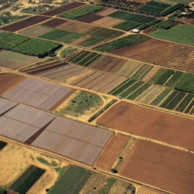
The dataset for this competition contains a time-series of satellite imagery and labels for crop type that have been collected through aerial and ground survey. Labels are derived from the survey conducted by the Western Cape Department of Agriculture. Satellite data including multispectral Sentinel-2 are then matched with corresponding labels.
In this competition you are asked to use ONLY Sentinel-1 time-series data. The time-series is provided every 12 days, but you do not need to use the observations from all days. You are allowed to select specific dates, or apply any pre-processing and feature extraction to the time-series data before input to your model. Note that you would need to provide your full feature-extraction and training scripts if you win in the competition.
Data for this competition is hosted on Radiant MLHub - the open-access repository for geospatial training data. You can access the data by creating a free account on Radiant MLHub. Go to Radiant MLHub Dashboard and use the Sign Up option if you don’t have an account.
You can download the data using Radiant MLHub Python Client (see the example notebooks) or simply by going to the Radiant MLHub Registry page. These links will be available once the competition starts.
You can use the following starter notebooks to learn more about the data and how to access them:
Variable definitions
- The label chips contain the mapping of pixel to crop type label. The following pixel values correspond to the following crop types.
- 0 - No Data
- 1 - Lucerne/Medics
- 2 - Planted pastures (perennial)
- 3 - Fallow
- 4 - Wine grapes
- 5 - Weeds
- 6 - Small grain grazing
- 7 - Wheat
- 8 - Canola
- 9 - Rooibos
- Each label chip also contains a mapping of pixel to field ID. The value of the pixel corresponds to the field ID which the pixel belongs to. These field IDs are the same as the field IDs present in the field_info_(test/train) csv files.
Files available for download:
ref_south_africa_crops_competition_v1_train_labels.tar.gz
- _common
- documentation.pdf
- field_info_train.csv
- Contains the target. This is the dataset that you will use to train your model.
- labels.json
- Contains the mapping of raster value to crop type
- ref_south_africa_crops_competition_v1_train_labels_{CHIP_ID}
- field_ids.tif
- labels.tif
- stac.json
ref_south_africa_crops_competition_v1_train_source_s1.tar.gz
- ref_south_africa_crops_competition_v1_train_source_s1_{CHIP_ID}_{DATE}
- VV.tif
- VH.tif
- stac.json
ref_south_africa_crops_competition_v1_test_labels.tar.gz
- _common
- documentation.pdf
- sample_submission.csv
- Shows the submission format for this competition, with the ‘Field ID’ column mirroring that of field_info_test.csv and the ‘Crop’ column containing your predictions. The order of the rows does not matter, but the names of the Field ID must be correct.
- field_info_test.csv
- Resembles field_info_train.csv but without the target-related columns. This is the dataset on which you will apply your model to.
- labels.json
- Contains the mapping of raster value to crop type
- ref_south_africa_crops_competition_v1_test_labels_{CHIP_ID}
- field_ids.tif
- stac.json
ref_south_africa_crops_competition_v1_test_source_s1.tar.gz
- ref_south_africa_crops_competition_v1_test_source_s1_{CHIP_ID}_{DATE}
- VV.tif
- VH.tif
- stac.json
Join the largest network for
data scientists and AI builders