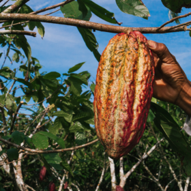
Africa Biomass Challenge

Helping Côte d'Ivoire
$10 000 USD
Completed (~3 years ago)
Earth Observation
Prediction
1224 joined
275 active
Start
Jan 27, 23
Close
May 21, 23
Reveal
May 21, 23
About
You will be using earth observation data, GEDI and Sentinel-2. You can view a report on how the ground truth data was collected and combined for this challenge in the report in the download section.
Vous utiliserez des données d'observation de la terre, GEDI et Sentinel-2. Vous pouvez consulter la façon dont les données de vérité au sol ont été collectées et combinées pour ce défi dans le rapport de la section téléchargement.
How to use Colab on Zindi
How to mount a drive on Colab
Files
Description
Files
If you are in the top 10 of the challenge you will need to submit a document similar to this that explains your solution.
If you are in the top 10 of the challenge you will need to submit a document similar to this that explains your solution.
Is an example of what your submission file should look like. The order of the rows does not matter, but the names of the ID must be correct.
This is a starter notebook to help you make your first submission. If the file open weirdly you can ctrl-S and it will save to your download folder.
Join the largest network for
data scientists and AI builders
Status
© Zindi 2026