Lacuna Solar Survey Challenge

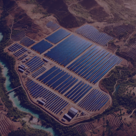
This dataset has been meticulously curated using a combination of satellite and high-resolution drone imagery to support the development of machine learning models for detecting and counting solar installations—specifically, solar panels and solar water heaters.
Each image in the dataset is accompanied by polygon annotations that localize zones containing these installations. Note that a single polygon may encompass one or more objects, rather than corresponding to individual installations. The annotation process followed a detailed multi-step approach:
- Initial Identification: Visual detection of potential solar panels using low-resolution satellite images.
- Field Verification: Approximately 25% of the identified cases underwent on-site verification to ensure accuracy.
- Data Acquisition: Both satellite and drone images were captured, with the latter offering higher resolution.
- Manual Annotation: Experts manually delineated polygon regions to mark areas with solar panels and solar water heaters.
The dataset is split into 3,312 training images and 1,107 test images. In addition to the polygon annotations, each image is enriched with metadata:
- img_origin:
- "S" indicates a satellite image.
- "D" indicates a drone image.
- placement: Provides context on installation environments:
- roof: Installations on rooftops or terraces.
- openspace: Installations in open courtyards or gardens.
- r_openspace: Installations that span both rooftops and outdoor spaces.
- S-unknown: For satellite images where the specific placement could not be determined.
The targets for each annotated zone are:
- nbr_pan: The number of solar panels.
- nbr_boil: The number of solar water heaters.
Participants should note that while the polygon annotations are carefully crafted, some may be imprecise. It is up to you to decide on the best strategy to handle such cases in your model.
Please ensure that only the provided dataset is used, as external data sources are not permitted—this is crucial for the solution to be applicable in the unique contexts found in Madagascar.
Find the full dataset here.
Join the largest network for
data scientists and AI builders